

The Council for Geoscience (CGS) has on Monday the 19th of June 2017 handed over geological maps to the Saldanha Bay Municipality. This, as the CGS is currently embarking on an intensive, integrated and multidisciplinary 10 year geological mapping programme that will see the country mapped at a scale of 1:50 000. The announcement was made early this February at the Mining Indaba by the Minister of Mineral Resources, Mr Mosebenzi Zwane. Accordingly, this sets the tone for the CGS as it begins to integrate the pockets of geological information that exist, as stipulated in its plan of action of the 10 year mapping programme. The map sheets, which cover the Vredenburg, Velddrif and Saldanha areas, were compiled as part of the 1:50 000 scale map series, based on aerial photographic and field mapping that was completed some years ago led by a former employee of the CGS and now retired geologist Dr Peter Siegfried, and Dr Dave Roberts (deceased). The cartographic work was undertaken by Ms Elmi Pretorius (also former employee) and others at the CGS Head Office. Prior to the actual handover, Dr Siegfried painstakingly explained the geology of the areas covered by the maps. The maps accompanied by a sheet explanation sheet that provides a description of the geological units and their history of formation, were handed over to the Executive Mayor of the Saldanha Bay Municipality, Councilor Marius Koen.
The young sands and limestone of the area is underlain by folded, fractured and metamorphosed sedimentary rocks of the Malmesbury Group intruded by granites of the Cape Granite Suite. The Malmesbury is approximately 560 million years old and compromise mostly of quartzite and shale that, due to intense fracturing and deep weathering mostly occur under sand and in topographically depressed areas, outcropping only along the coast. The granites are more resistant to weathering than the Malmesbury rocks and as a result dominate the landscape as rounded hills and ridges. The textures vary from fine to coarse grained and there are about 25 different types that differ in physical characteristics and compositions that have been identified in the map area. The different granite types of the Saldanha and Vredenburg are separated by a prominent fault in the area named the “Colenso fault” which runs across the Vredenburg-Saldanha road.The mining history of the aforementioned areas mainly entailed the exploitation of industrial and construction materials notwithstanding the discovery of two important underground water resources, namely the Langebaan Road and Elandsfontein aquifers which could play an important role in the local water supply.
Cllr Koen expressed gratitude to the CGS for geologically mapping such critical areas within their Municipality. He added that this geological information will assist the Saldanha Bay Municipality in identifying suitable areas for future infrastructural and human settlement developments as well as effective disaster management planning. The maps were handed over by the Acting Chief Operations Officer, Mr Fhatuwani Ramagwede and the Chief Financial Officer, Mr Leonard Matsepe. Mr Matsepe explained that there is immense value in this type of information for future developments within the Municipality, while Mr Ramagwede urged the Municipality to get in touch with the CGS for information sharing of seismic activity patterns and engineering geological data of the West Coast to aid in their infrastructural developmental planning.
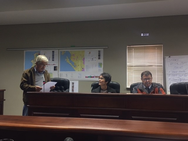
Dr Peter Siegfried describing the geology of the maps, pictured here with Ms Elmi Pretorius and
the Acting Municipal Manager.
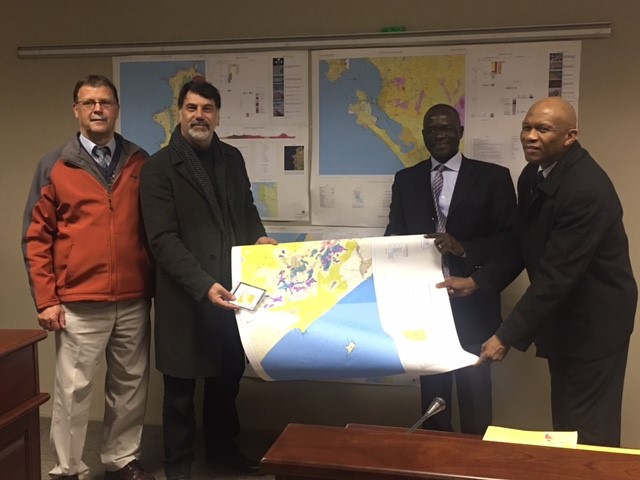
The Acting Municipal Manager and Executive Mayor posing with the CGS’ Acting COO and CFO