As part of a countrywide incentive driven by the Department of Mineral Resources (DMR) to advance and support mining in South Africa, the Council for Geoscience has proposed several projects to investigate the mineral potential of specific minerals and the general mineral potential of various target areas in an attempt to promote sustainable mining and exploration. In 2015, the CGS launched a number of DMR-funded projects, including an investigation of the mining potential of the alluvial diamond fields in the North West Province using high-resolution geophysical surveys, remote sensing data and field mapping. The project focusses on mapping and associated research to determine the origin, character, transportation, distribution and trapping of diamonds in alluvial gravel. The results from these investigations will empower the Council for Geoscience to provide informed suggestions to the local communities and miners enabling them to perform cost-effective and sustainable mining and to propose exploration methods and targets for future mining.
Alluvial mining in the area started in the early 19th century. Renewed interest in the mining of alluvial diamonds was generated by the El Niño related drought of 1974 when many farmers turned to diamond mining. Much larger volumes of gravel could be moved and greater depths of gravel were reached owing to modern earth moving and sorting equipment. The drought and the presence of the El Niño weather phenomenon during 2015–2016 are only coincidental in this study. The geological mapping programme for the project was initialised and detailed planning commenced with a workshop held on 16 July 2015 at the Council for Geoscience head office in Pretoria. Participants in the mapping project included: Pieter Bosch, Refilwe Shelembe, Dawn Black, Victor Mothetha, Hendrik Minnaar, Debbie Claassen, Jurie Viljoen, Neo Moabi, Tebogo Maja, Ponani Mthembi, Portia Munyangane, Sisanda Makubalo and Pumelela Mlokothi.
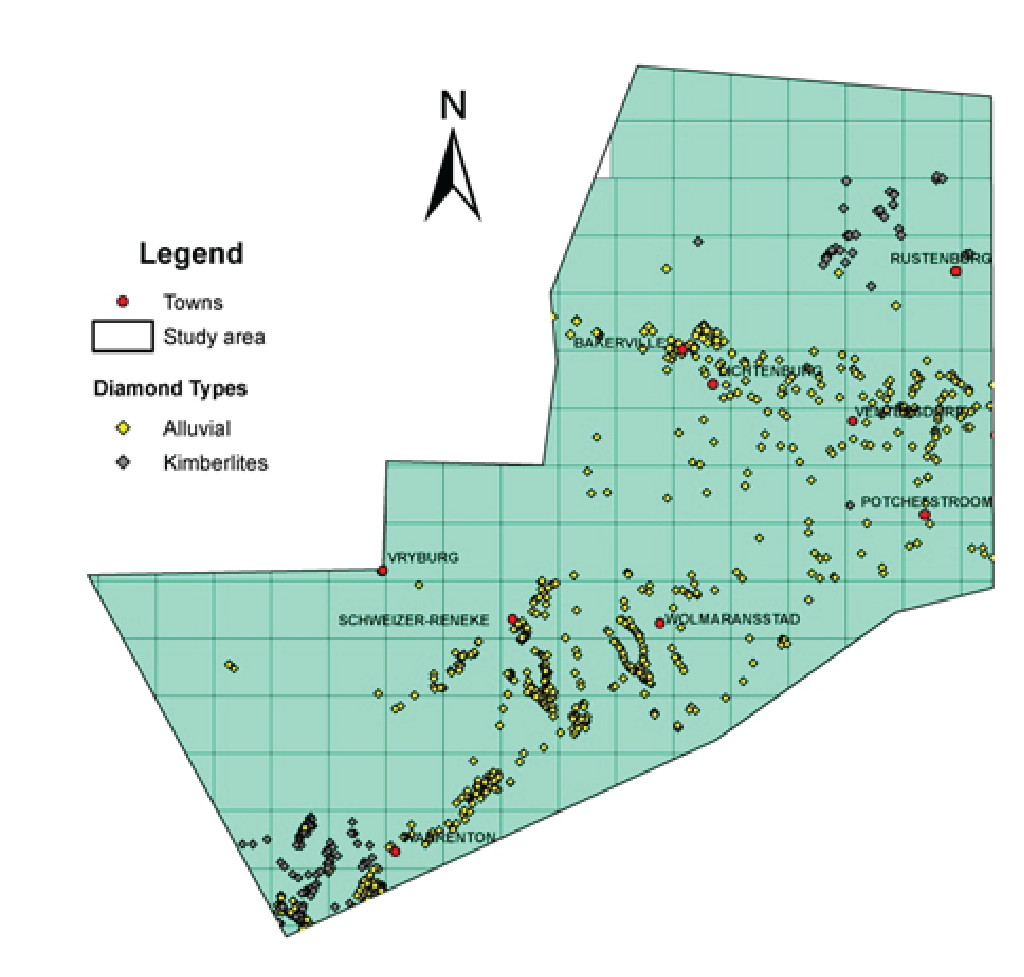
The distribution of known diamond occurrences was plotted on maps with a background showing the rivers and elevation data overlain onto 1:50 000-scale topographic maps. Field mapping was done from 2 August to 30 October 2015 during which time alluvial diamond occurrences were visited in the field and described systematically using standardised data sheets. Targets generated by remote sensing and geophysical data were also visited. About sixty-five 1:50 000-scale topographic maps were targeted and approximately 100 samples were obtained for heavy-mineral separation and indicator mineral identification studies.
The diamondiferous gravels are distributed predominantly in three major areas, namely the area underlain by dolomite from the east of Ventersdorp towards Lichtenburg and Bakerville and beyond (VLB), the Lichtenburg–Delareyville–Bloemhof–Klerksdorp–Lichtenburg area (LDBKL), which is mostly underlain by Ventersdorp Supergroup basalt and Dwyka Group tillite and the area associated with the Vaal River terraces and gravels. Diamondiferous gravels are concentrated along straight and meandering runs, sinkholes and dolines in the VLB area. In the LDBKL area, the diamonds are present in ancient and current river channels, terraces or banks and as elluvial and colluvial deposits. Along the Vaal River, the diamonds occur along the gravels of the current river and along the older gravels present along ancient terraces.
During the study, it was found that the processes, structures and deposits associated with the Dwyka Group, karst formation, erosion and fluvial activity since the Cretaceous period associated with the uplift and erosion of the African surfaces and pedogenesis played a major role in the transportation, concentration and confinement of the alluvial diamonds. It is now hypothesised that some diamonds were transported by ice sheets and glaciers during Dwyka Group deposition and may have concentrated along eskers and/or drumlins and/or as a thin sheet of moraine on the Chuniespoort Group dolomite. The directions of movement of the glaciers and preferred orientations of the eskers and possibly drumlins suggest that the 1 180 Ma, 32 hectare Cullinan kimberlite pipe may have been a major source of alluvial diamonds in the North West Province. Relatively thicker deposits of moraine and end-moraine were deposited by fluvioglacial streams and during the melting of ice sheets in the areas predominantly underlain by the Ventersdorp Supergroup (LDBKL area). The extent of underlying moraine in the LDBKL area is inferred from tillite exposed in excavations, erratics on surface and small round pans possibly related to kettles. The eskers and drumlins were possibly the forerunners of the straight and meandering runs which were later deepened by karstic processes as the dolomite was exhumed during uplift and related African erosion cycles. These deeper runs with sinkholes and isolated sinkholes formed concurrently as they were progressively filled with the resistant remains of the Dwyka Group and Karoo rocks, including the Drakensberg basalt. The autochthonous weathering and dissolution of the dolomite account for the large percentage of locally derived chert in some of these gravels.
It is also possible that some diamonds were transported from Cretaceous diamond-bearing pipes along streams formed during the uplift and buckling of the Kaapvaal Craton. The Vaal River formed an early barrier for the transportation of diamonds to the south and north. The current river shows downcutting of at least 550 m along the Vredefort Dome which suggests that it was already in existence while the Ventersdorp Group basalt and Chuniespoort Group dolomite were being covered by Karoo Supergroup rocks and Drakensberg basalt. This makes the presence of diamonds from the Free State kimberlite pipes in the North West Province alluvial diamond fields unlikely. However, transportation of diamonds from known sources, including the kimberlite dykes at Swartruggens, is possible from the early Cretaceous up to the period during which northeast oriented buckling in the crust formed a watershed just north of Bakerville which terminated streams flowing to the south and southwest.
It is apparent that Dwyka glaciation had an important influence on the distribution of the diamondiferous gravels and the identification of glacial structures and deposits may therefore be an important aid in targeting potential diamond exploration areas.
For more information contact:
Pieter Bosch
Geoscience Mapping
+27 (0)12 841 1350