- +27 12 841 1911
- 280 Pretoria Street, Silverton, Pretoria

South Africa
Eastern Cape Project
Geoscience for Infrastructure and Land Use
Conduct hydrogeophysical studies to develop groundwater potential maps.
Eastern Cape Project
South Africa is one of the world’s most water-scarce countries. Therefore, the Council for Geoscience decided to initiate a deliberate attempt to contribute to the relief of water scarcity in the Eastern Cape Province. In recent years, South Africa has experienced below average rainfall. The Eastern Cape Province, in particular, has experienced very severe drought. The region suffers from a lack of potable water as a result of frequent droughts. In order to assist in boosting the water resources of this and other drought-stricken areas, the Council for Geoscience aims to conduct hydrogeophysical studies to develop groundwater potential maps which will be used to highlight and target areas hosting high-yielding aquifers. These aquifers, should they host water, will be drilled and their water will be provided to the communities for household and agricultural use. In this regard, the Council for Geoscience has identified areas that require further geological and hydrogeological characterisation. Geophysical information, such as airborne electromagnetic (AEM) data will be used to characterise possible aquifers on a regional scale. The geology will be mapped and structures with the highest groundwater flow potential will be targeted for drilling. The Eastern Cape Province mapping project also aims to develop fundamental geological information that will assist in characterising the rate of soil and lithology erosion and identifying the lithologies and structures that control the flow and concentration of groundwater resources. In addition, the project will consider regional industrial mineral resources to support local infrastructure development.

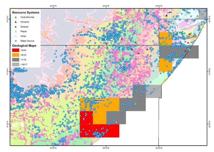
Locality map highlighting the targeted geological areas within the Eastern Cape Province. Mineralising systems and areas hosting known hydrogeological resources are also shown.
Key Objectives:
- Characterising the natural and geological controls on anomalously rapid erosion and fundamental stratigraphic and structural information to assist in locating potentially undefined groundwater resources.
- Characterising regional aquifers.

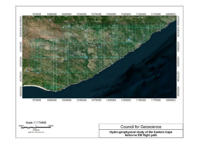
Airborne electromagnetic (AEM) hydrogeophysical line path in the Eastern Cape.


