- +27 12 841 1911
- 280 Pretoria Street, Silverton, Pretoria

South Africa
Free State (Maluti)
Geoscience for Health, Groundwater and the Environment
Focus on developing fundamental geological information
Maluti a Phofong Geoscience Mapping Project
In recent years, South Africa has experienced below average rainfall. The Free State (Maluti) area, in particular, has experienced very severe drought. The region often suffers from a lack of potable water as a result of frequent droughts. In order to assist in boosting the water resources in the area, the Council for Geoscience aims to conduct hydrogeophysical studies. The principal aim of this project is to collect and integrate geological datasets to support infrastructure development and geohydrological and environmental management across the Maluti-a-Phofong poverty node. This geoscience mapping project will focus on developing fundamental geological information with a view to characterising potential and previously undefined sequences of economic interest — for example, diamondiferous alluvial gravels and the lithologies and structures controlling the flow and chemistry of groundwater resources. The information will aim to contribute towards sustainable natural resource development within the Maluti-a-Phofong region.

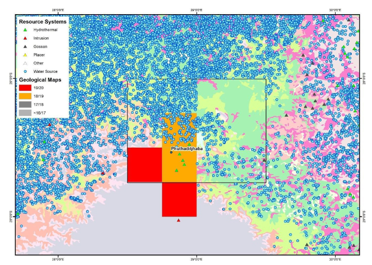
Overview of the Maluti-a-Phofong geoscience mapping project area, highlighting significant mineral occurrences.
Key Objective:
- Developing geological information to support the identification of lithologies hosting potentially undefined mineralising systems and establishing controls on the flow and chemistry of groundwater resources.

